

(Bullock, Pike, Macon, Montgomery, Barbour Area)
1800 – 1814 INDIAN TERRITORY
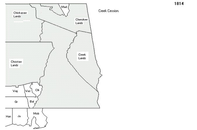
According to Wikipedia, In the early 1800s, the United States government began a systematic effort to remove American Indian tribes from the southeast. The Chickasaw, Choctaw, Muscogee-Creek, Seminole, and original Cherokee Nations[7] had been established as autonomous nations in the southeastern United States. This acculturation was originally proposed by George Washington and was well under way among the Cherokee and Choctaw by the turn of the 19th century.[8] In an effort to assimilate with American culture, Indians were encouraged to “convert to Christianity; learn to speak and read English; and adopt European-style economic practices such as the individual ownership of land and other property (including, in some instances, the ownership of African slaves).”[9] Thomas Jefferson’s policy echoed Washington’s proposition: respect the Indians’ rights to their homelands, and allow the Five Tribes to remain east of the Mississippi provided that they adopt behavior and cultural practices that are compatible with those of other Americans. Jefferson encouraged practicing an agriculture-based society. Andrew Jackson sought to renew a policy of political and military action for the removal of the Indians from these lands and worked toward enacting a law for Indian removal.[10][11] In his 1829 State of the Union address, Jackson called for removal.
1815 MONROE COUNTY
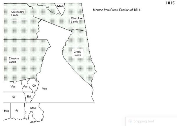
For the Eastern area of Alabama, because the land was still owned and controlled by Indians, there wasn’t an 1800 and 1810 United States Census. As early as 1815, we can see how American’s slowly began to take over the territory of Alabama. For the Bullock/Pike area, the land at that time was actually the County of Monroe.
1816 – 1817 MONROE COUNTY
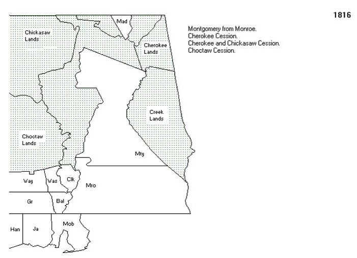
Then in 1816, the county of Montgomery was created from Monroe and Conecuh was created from Monroe which makes sense because as individuals began relocating to this area, all of the land grants were issued out of Conecuh.
1818 MONROE COUNTY
 Then in 1816, the county of Montgomery was created from Monroe and Conecuh was created from Monroe which makes sense because as individuals began relocating to this area, all of the land grants were issued out of Conecuh.
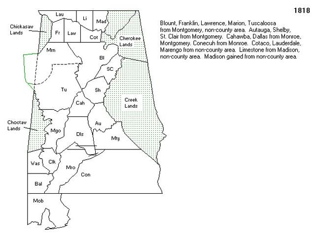
1819 – 1820 Montgomery, Henry & Butler Counties
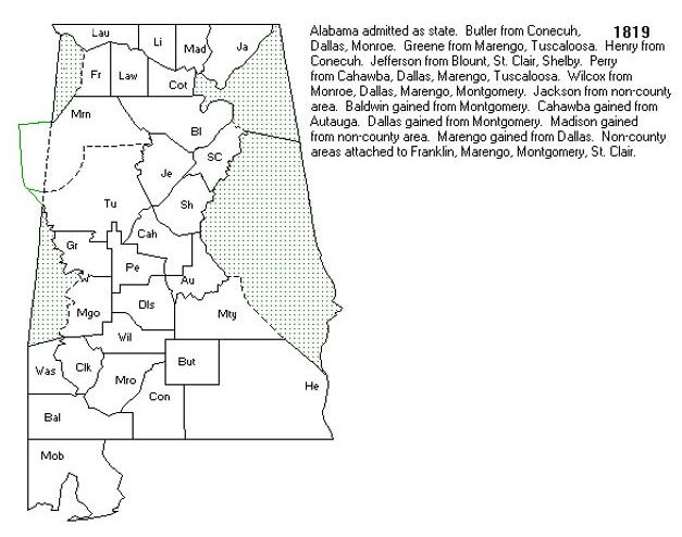 Then in 1819, Alabama was finally admitted as a state and Henry county was created from Conecuh. Butler county was formed from Conecuh and Henry county. This formation was in existence when the 4th Enumeration Census of 1820 was taken. Only the heads of households were recorded. What’s most interesting is there is NO census information for Alabama for 1820 even though there were counties formed. Many of these must have just been territories and not counties.
1821 – 1823 Montgomery, Henry & Butler Counties
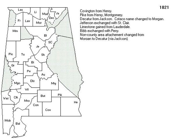 Then in 1821, Covington county was created from Henry and Pike was created from Henry and Montgomery. These facts are significant because when you finally try to trace your family members to the early 1820’s the land and county lines changed and you might be confused where they are actually living. Also, when slaves were bequeathed, the children and family members of the slave holder lived in an adjacent county that by 1870 and 1900’s seems to no longer be relevant but is very relevant due to the many land formation changes.
1824 Montgomery, Henry & Butler Counties
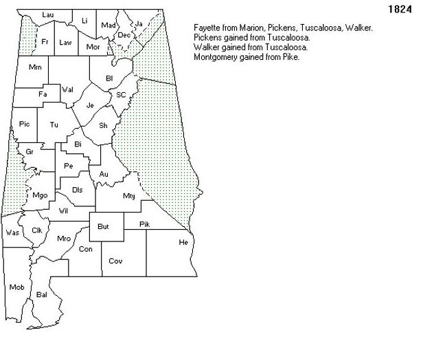
Then in 1824, Montgomery gained additional land from Pike so the families living in Pike are now living in Montgomery. This is important because for the 1830 census, you might have to look for or there may be reference to property for both slave and probate records in both counties. Also remember Butler is adjacent to Pike and Covington so when the land lines change later, the area closes to Pike and Montgomery will be in a different area so it’s important to look in Butler to be sure you aren’t missing anyone one.
1825 Dale is created from Covington and Henry County
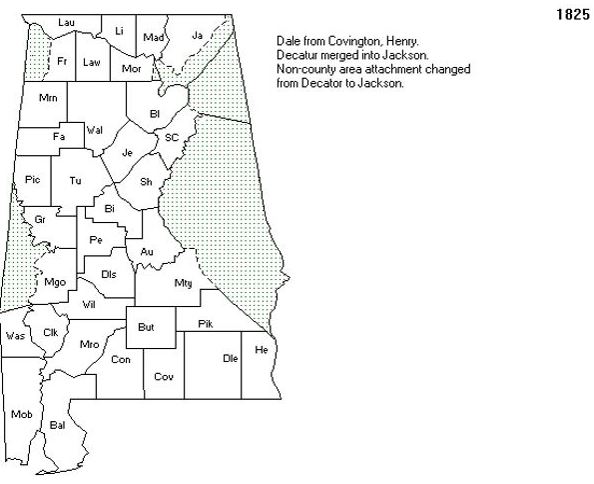
Then in 1825, Dale county became a county of reference because of the land formation from Covington and Henry.
1828 Butler gained land from Pike and Pike from Dale County
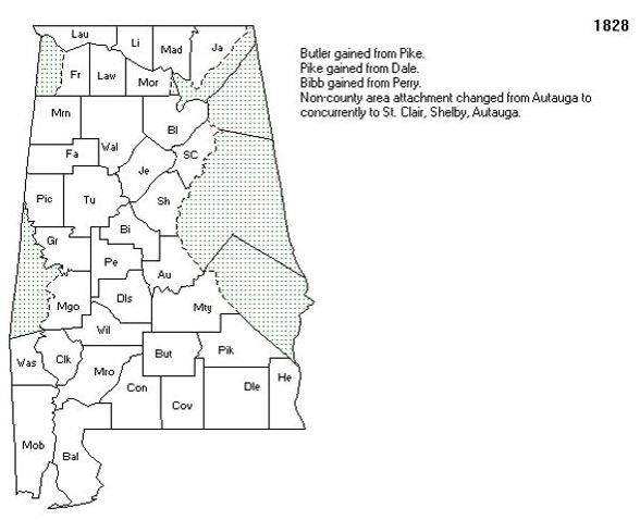 Then in 1828, the western area of Pike gave land to Butler and the southern area of Pike gained land from Dale. For researching Pike County, once again, you have to look at where the slave owner lived to see where they bequeathed their property and if the recipient still lived in the area adjacent to Pike or Montgomery.
1829 Montgomery and Pike gained more Indian Territory
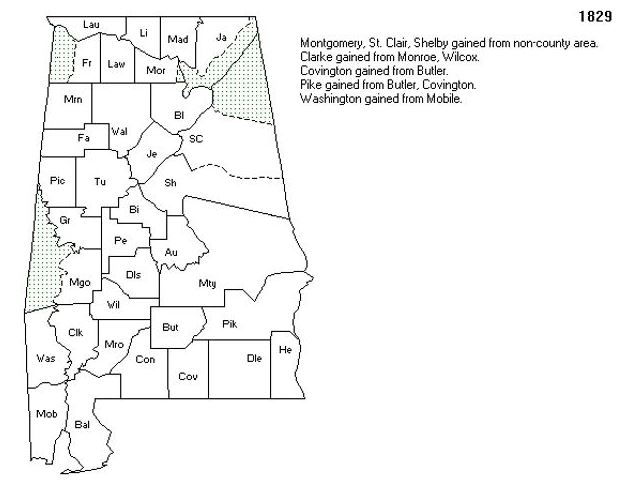 Then in 1829, both Montgomery and Pike county gained Indian Territory and Pike also gained land from Butler and Covington. This was the land formation for the 1830 census.
1830 Lowndes was created from Montgomery, Pike
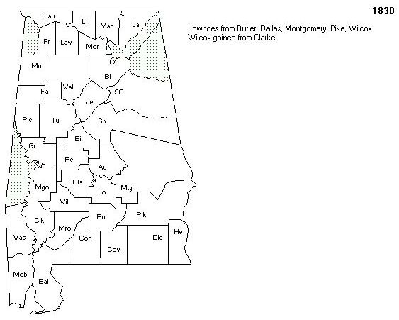 Then in 1830, Lowndes was create from Montgomery, Pike and Wilcox. The significance for this is the town lines changed right before the 1830 census so individual living in the Western area of Pike might be recorded in the 1830 census and not in Pike.
1832 Lowndes was created from Montgomery, Pike
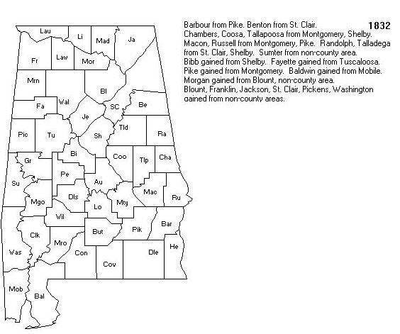 Then in 1832, Barbour County was created from Pike. Tallapoosa from Montgomery and Macon and Russell was created from Montgomery county and Pike gained land from Montgomery.
1837 Macon, Montgomery and Pike changes
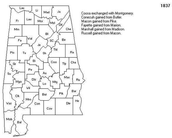 Then in 1837, Macon gained land from Pike and Russell gained land from Macon and for the next 29 years, the land in the the Macon, Pike, Barbour and Montgomery area didn’t change “significantly for the 1840, 1850 and 1860 census.
1866 Bullock County is Formed
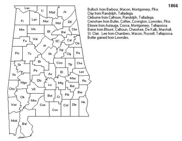 Then in 1866 Bullock county was formed from Barbour, Macon, Montgomery and Pike
1867 Bullock County is Formed
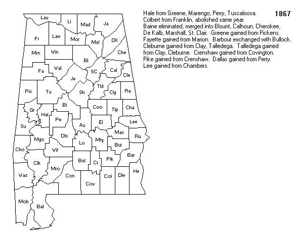 Then in 1867, there was a slight change in the land formation for Bullock and Macon county. This change remained until the 1870 census when the slaves were emancipated, and EVERYONE was recorded on the same census.
1870 County Formation for the census after Emancipation
Copies of map taken from: Interactive Map of Alabama Counties Formation